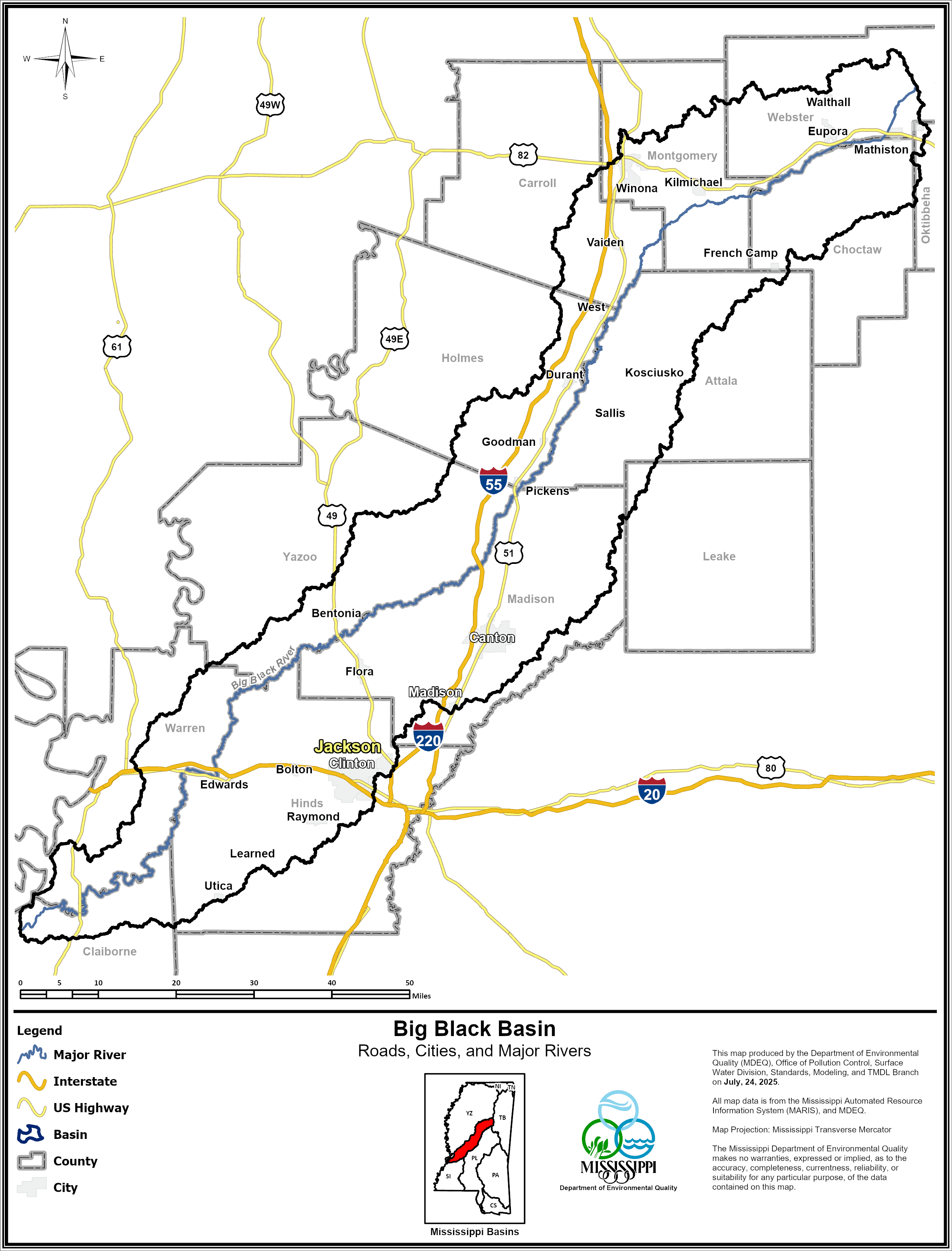
Big Black River Basin
| Land-Use |
Surface Water Quality |
TMDLs |
Priority Watersheds |
The Big Black River Basin drains a central portion of the state that is approximately 3,384 square miles. The Basin is approximately 155 miles long and averages 22 miles in width. The only major waterway in the basin is the Big Black River which begins in Webster County near the town of Eupora and flows southwesterly for approximately 300 miles to its outlet to the Mississippi River twenty-five miles south of Vicksburg.
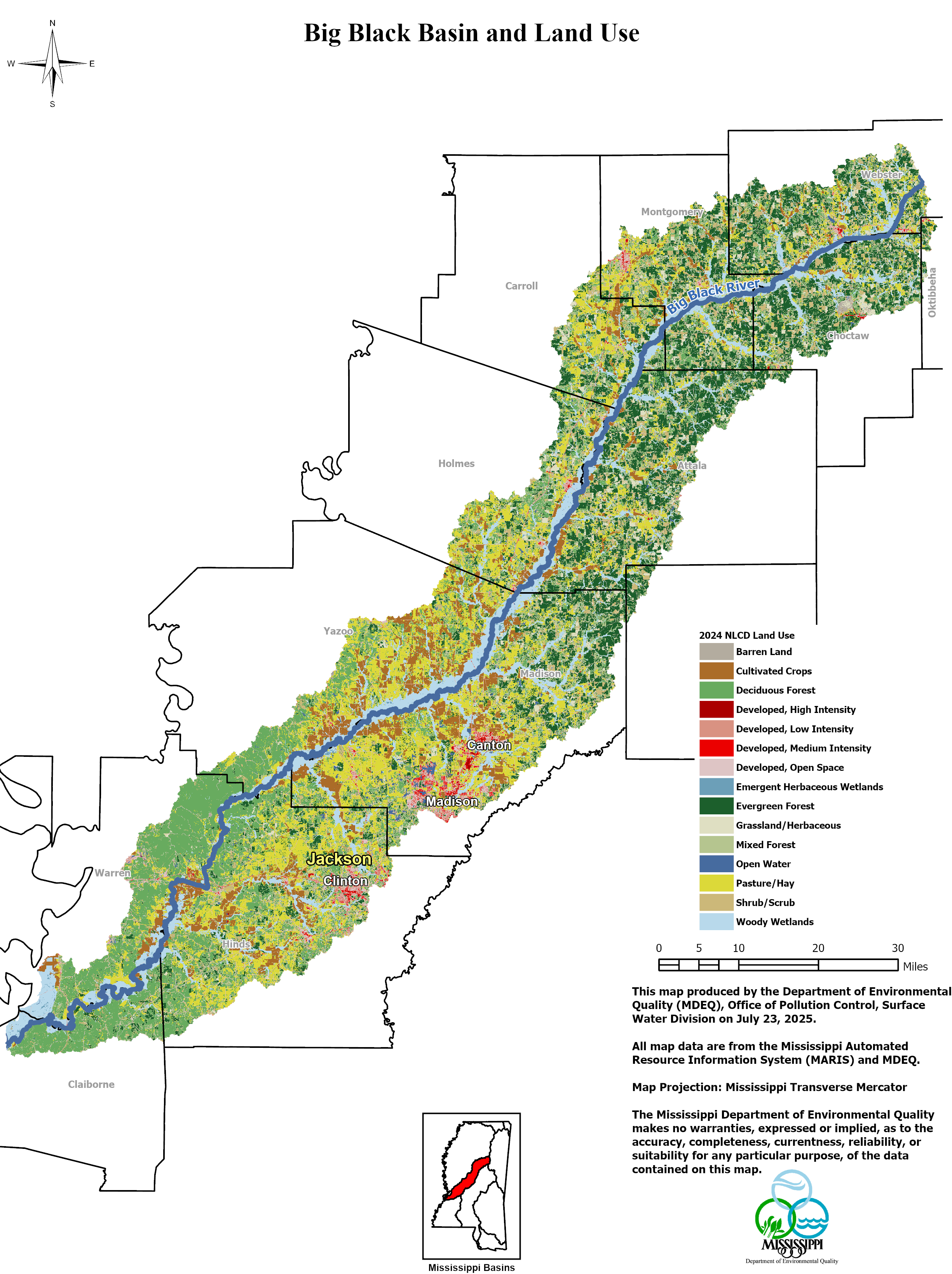
Land Use in the Big Black River Streams Basin
Forests, agriculture, urban areas, and highways all have different influences on the amount and quality of water that runs off into streams and rivers. The Big Black River Basin is home to a mix of bottomland forests, upland pine-hardwood stands, mixed oak-hickory hardwood forests, wetlands, and agricultural lands.
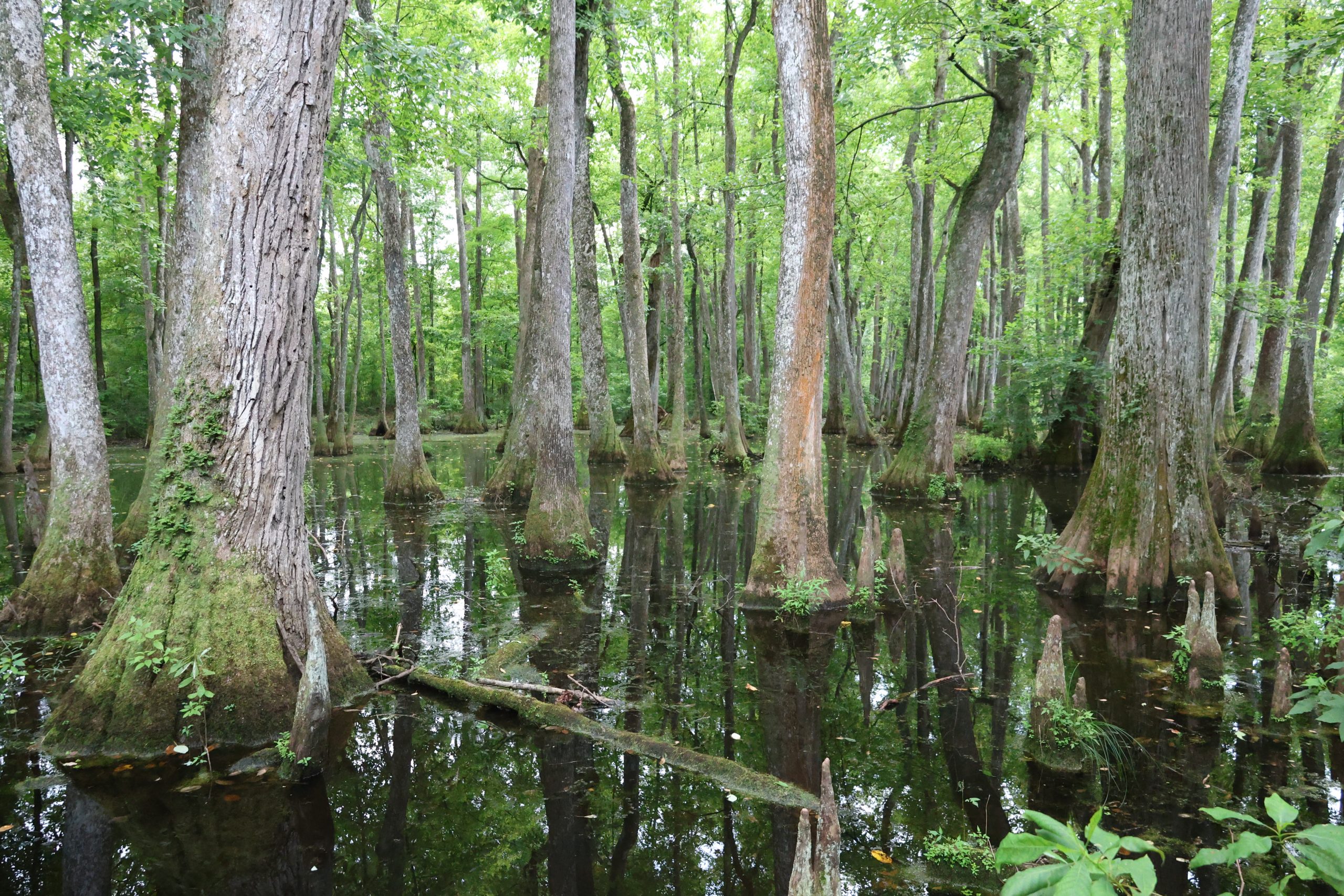
Wetlands
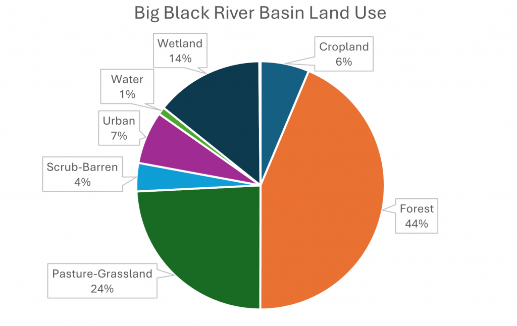
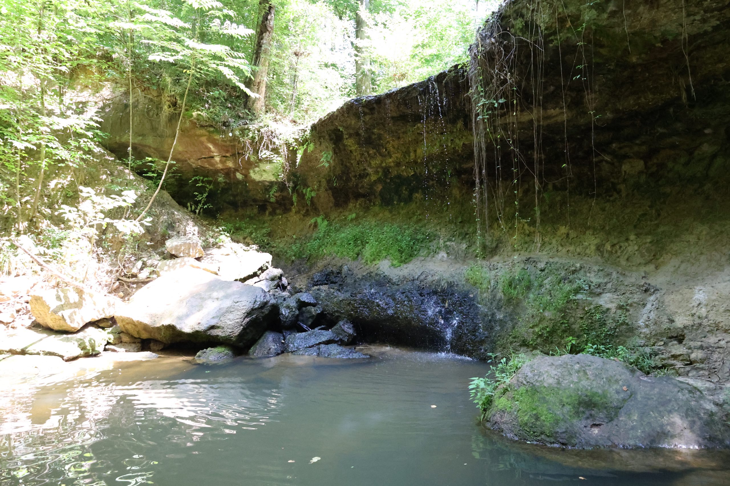
Wetlands are among a river’s greatest assets, and Mississippi’s wetland management goal is “no net loss of wetlands”. Wetlands filter pollutants, replenish ground water and stream flow, and act like sponges to reduce flooding by storing runoff. Like an enormous water filter, wetlands remove pollutants naturally and at no cost. Wetlands do the work of water treatment plants that would cost tens of millions of dollars to build. Wetlands also provide essential habitat for a great variety of animals and plants, both aquatic and terrestrial. Wetlands make up about 14% of the land area in the Big Black River Basin, with a variety of habitats from swamps and sloughs to oxbow lakes and flooded depressions.
Through its 404 Permitting Program, the U.S. Army Corps of Engineers protects against the loss of wetlands and mitigates impacts to these critical ecosystems. The permitting program also protects many bottomland hardwood forest areas, some of which are classified as wetlands.
Forests and Timberlands
Covering some 44% of the land area in the Big Black River Basin, mixed upland hardwood forests, pine forests and planets pine stands offer habitat to a diversity of plant and animal species.
The forestry industry contributes substantially to the economy of the Big Black River Basin; however it can affect water quality if not properly managed. Many foresters and landowners have voluntarily installed practices designed to protect and restore water quality: improved stream crossings, selective cutting, and streamside buffers. Streamside buffers reduce sediment running into the stream and provide shade that keeps the water cooler. Intact streamside forests also hold bank soils in place and provide excellent wildlife habitat. Erosion and runoff from unprotected clear cuts, on the other hand, add excess sediment to streams, destabilize stream channels, and damage or eliminate aquatic habitat.
Click here to learn more about Forestry Best Management Practices in Mississippi
Agriculture
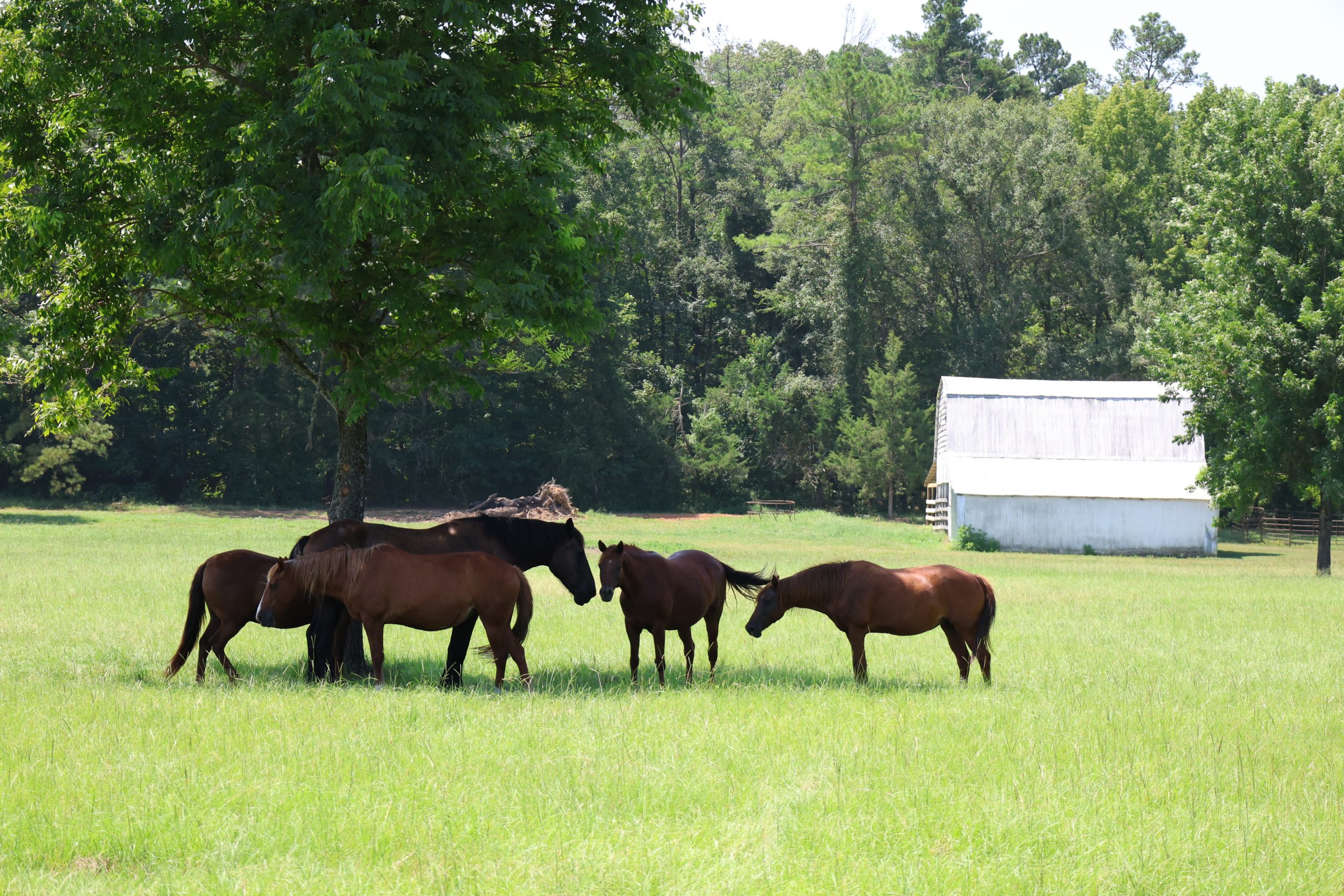
Cattle are the primary livestock produced in the Basin, with pasture and rangeland for covering about 24% of the land area. Nutrients and bacteria from animal waste can flow into streams from pasture runoff and/or directly from the animals themselves, and this may cause low dissolved oxygen levels and other water quality problems. When cows graze near streams, the stream banks and channels may also become unstable and erode. Bank erosion causes portions of the downstream channels to fill with sediment, affecting habitat for fish and aquatic life. The farming community, in coordination and with support from MDEQ and Basin Stakeholders are already at work on these problem areas through the implementation of waste management plans, by restricting cattle access to streams, and by improving stream crossings.
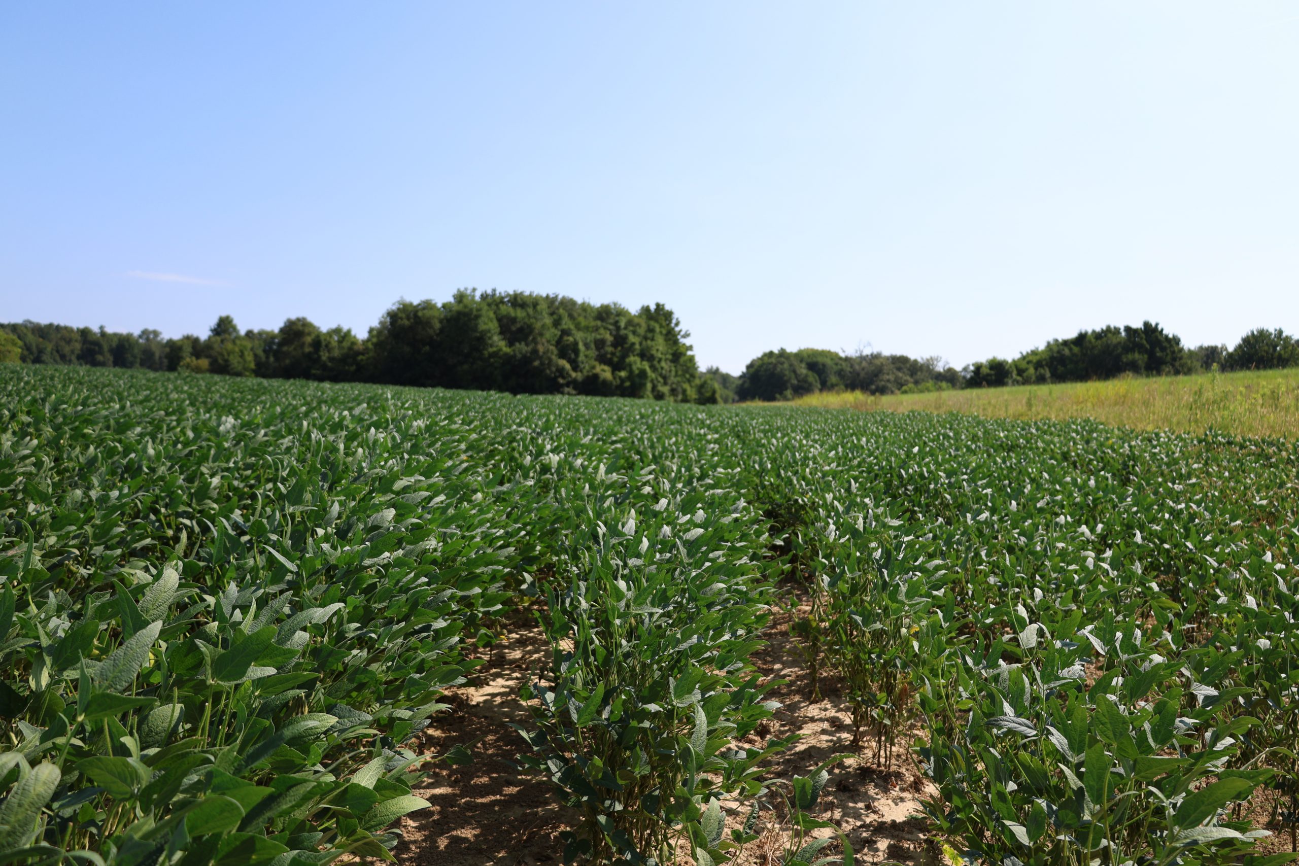
The fertile soils in the Basin also support a strong row crop sector primarily consisting of soybean, cotton and corn covering 6% of the land area. In recent years, state and federal agencies have stressed the need for soil conservation and good farming practices, such as no till farming and maintaining vegetated stream buffers. By keeping topsoil in place, these practices help keep sediment out of the streams. Many of these same practices also reduce fertilizer and pesticide runoff saving farmers time and money.
Click here to learn more about Best Management Practices for livestock in Mississippi.
Click here to learn more about Best Management Practices for row crops in Mississippi
Farmers should contact their local U.S. Department of Agriculture Service Center to discuss opportunities and resources available through the Natural Resource Conservation Service and Farm Service Agency.
Cities and Suburbs
Urban areas make up a small portion of the Big Black River Basin covering 7% of the land use. The Basin is sparsely populated in most areas, with small towns dotting the countryside. A majority of the population is located in the central part of the Basin in Madison and Hinds Counties surrounding Jackson. As suburbs of Jackson, the nearby cities of Clinton, Canton, Gluckstadt and Madison are all experiencing extensive residential development. Madison county grew by 51% (38,000 residents) from 2000-2023 while Hinds county’s population declined by 14% (36,000 residents) over the same time period. This significant shift in population has resulted in broad changes to both the region’s economy and nonpoint source pollution management challenges and objectives.
While urban areas cover only a small area in the basin, they can impact water quality in many significant ways. During highway and building construction, disturbed land erodes and runoff carries excessive sediment if the site is not properly managed. Once construction is complete, stormwater runoff from developed areas flows into streams more quickly and with a higher volume than natural lands. As a result, urban streams have larger and more frequent floods than undisturbed rural streams. The increased flow and velocity also causes scouring, erosion, and sedimentation to the stream channels. Urban runoff frequently contains pesticides, herbicides, and fertilizers from lawns and other managed landscapes. To help address these impacts, the state now requires stormwater permits for many communities.
Urban runoff frequently contains pesticides, herbicides, and fertilizers from lawns and other managed landscapes. To help address these impacts, the state now requires stormwater permits for many communities. Cities and towns attract industry, and sometimes these industries generate pollutants as by-products. These by-products have the potential to negatively impact our streams and air. Mercury and other pollutants discharged into the air can travel many miles, even across state boundaries, before settling onto the ground and washing into streams and lakes. Regional solutions are necessary to address these interstate problems. Both air and water discharges are regulated by MDEQ through permits to limit them to acceptable levels.
Click here to learn simple practices to help protect Mississippi waters.
Surface Water Quality Standards
Mississippi water quality standards establish the goals for protecting and maintaining the quality of our surface waters (streams, lakes, estuaries, etc.) so that they will support their intended or designated uses. In Mississippi, designated uses are fish and wildlife support, public water supply, recreation, and shellfish harvesting. With the exception of fish and wildlife support, not all uses apply to each water body—rather each is assigned specific uses. Click here to view specific designated uses for different waterbodies.
Criteria are set for a large number of different water quality parameters. Monitoring is then performed to compare conditions, in individual streams, lakes or estuaries, to the criteria to assess whether the waters are supporting their designated uses. These criteria are also used to set limits on the amount of pollution that can be put into a water body while still protecting its uses.
Mississippi currently has 241 waterbodies listed as impaired on the 2024 §303(d) list, and 19 are present in the Big Black River Basin. Click here to view the Mississippi 2024 List of Impaired Water Bodies. Each impaired water body has a report completed for each pollutant causing impairment. Each TMDL report includes the suspected sources of impairment and estimates the pollution reduction necessary to restore the water body to its intended use.
Major pollutants and their sources include the following:
- Pathogens from animal wastes and failing septic systems.
- Pesticides from agricultural runoff.
- Eroded sediment from agricultural, timber harvesting, and construction sites.
- Organic and nutrient enrichment from animal wastes and failing septic systems.
The state’s most comprehensive assessment report is the State of Mississippi Water Quality Assessment Report 2024 Section 305(b). Click the links below for a map or a list of the designated waters of the Coastal Streams Basin.
Total Maximum Daily Loads
Simply put, Total Maximum Daily Loads (TMDLs) are pollution budgets. A TMDL determines how much of a pollutant can be present in a stream, river, lake, or other water body without affecting aquatic life or public health.
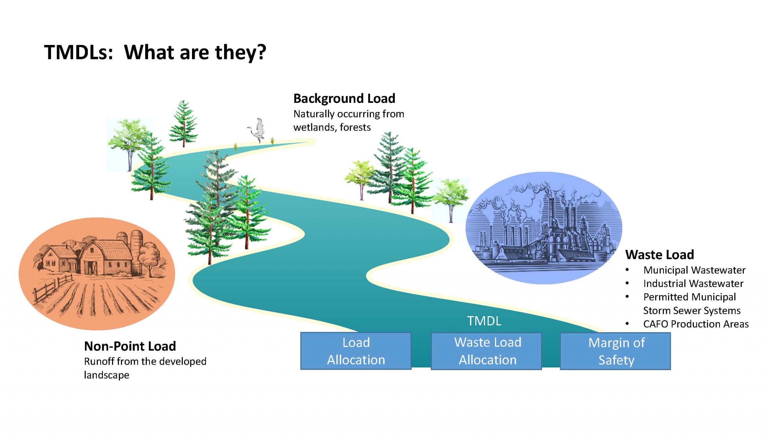
There are 44 water bodies with completed TMDLs within the Big Black River Basin Basin. Most of these TMDLs state the estimated amount of bacteria, sediment, or nutrients entering the waters and how much these pollutants should be reduced to restore water quality conditions. Both rural and urban communities need to work in partnership with resource management agencies to restore and maintain the water quality necessary to support aquatic life and safe public use in these waters. As ongoing monitoring activities find additional impaired streams, these are added to the list for TMDL development as well.
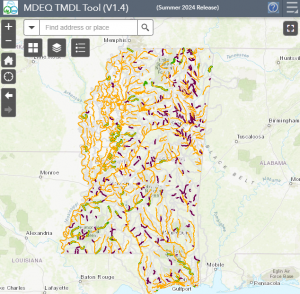
Click here to view an interactive map showing all Impaired Waterbodies and TMDLs.
Click here to access all Big Black River Basin TMDL Reports. For more information about activities relating to surface water, please visit the link to the Surface Water Division Home Page.
Drinking Water Protection
Ground water supplies most of the drinking water used in the Big Black River Basin. Private domestic wells are still widely used while most inhabitants in towns in the Basin have access to a public water supply.
Drinking water resources are protected by the federal Safe Drinking Water Act (SDWA). The SDWA establishes safe drinking water criteria (referred to as maximum contaminant levels or MCLs) and requires assessment of the areas around supply sources to evaluate potential threats and levels of protection that may be needed.
The public drinking water wells in the Basin are typically deep and draw from aquifers naturally protected from pollutants by thick layers of clay. Tests conducted by the Mississippi Department of Health have shown that water quality from public wells is of good quality.
In Mississippi, the State Department of Health regulates public water systems, and MDEQ assists in drinking-water, source protection through the Source Water Assessment / Protection Program.
For more information on drinking water assessments, visit the MDEQ’s Office of Land and Water Resources webpage.
Priority Watersheds
With so many water quality challenges, where do we begin to restore our degraded waters or protect our waters that are still in good condition?
To focus limited resources, we need to set priorities and target areas where our collective efforts will have the greatest benefit. Through the holistic Basin Management Approach, MDEQ and its partners have identified priority watersheds to focus restoration and/or protection efforts. To learn more about the watershed prioritization and Clean Water Act 319 non-point source grant program, click here to view the Mississippi Nonpoint Source Pollution Management Plan.
Click here to view the State’s Priority Watersheds that were identified using the process outlined in the Management Plan. To learn more details about specific project areas, click here to view the Watershed Plans and 9 Key Element Plans for priority watersheds with active or recently completed projects.
How can I learn more and get involved?
Contact Charlie Culpepper, Basin Coordinator for the Big Black River Basin, with any questions about the Basin or for up-to-date information about current projects.