Map Monday
New Sparta 7.5-minute Geologic Quadrangle Map
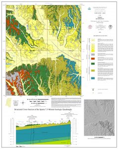 MDEQ’s Office of Geology is proud to announce the release of the Sparta 7.5 min. geologic quadrangle map produced in cooperation with Mississippi State University. This geologic
mapping project highlights the important scientific collaboration between research at our Mississippi Universities and the Mississippi Geological Survey under MDEQ with the goal to help produce additional high quality geological map publications at the standard for inclusion in our State Survey publications while training the next generation of professional geologists.
The availability of updated, detailed geologic maps are vitally important to our society. The Mississippi Geological Survey (under MDEQ as the Mississippi Office of Geology) has been conducting geological mapping and mineral resources studies for in our state since 1850. A number of our Survey reports, geological maps, and other studies over the years have been conducted in collaboration with our university scientists. These essential studies have played a vital role in many aspects of our state throughout its history including its mineral resources, agriculture, energy, economics, water resources, environmental, transportation, civil engineering planning, geohazards, and in the understanding and conservation of our natural and cultural history.
The Sparta 7.5 min. Geological Quadrangle was produced in cooperation with Mississippi State University and fills an important gap in geologic mapping coverage at the 7.5 min. scale in portions of Chickasaw and Clay counties in northwest Mississippi
Geological mapping is s process that involves a number of professional skills and broad knowledge base about the area being mapped. The geologic formations were delineated at the surface from outcrop data. Their stratigraphic relationships were characterized in the subsurface from the correlations of geophysical logs and projected to the surface. They were then field checked by studying both lithology at available outcrops and with biostratigraphy using fossils that the formations contain.
The geology encompassed by the Sparta 7.5 min Geologic Map coverage includes the bedrock geology of Late Cretaceous marine deposits of the Prairie Bluff, Ripley and Demopolis formations; the Paleocene marine deposits of the Clayton Formation and the terrestrial deposits of the Porters Creek Formation. Delineated surficial deposits include the alluvium of streams and stream terraces.
Attached is a link to a free download of Sparta 7.5 min. Geologic Map:
OF-366 Geologic Map of the Sparta Quadrangle Chickasaw and Clay Counties, Mississippi – MDEQ
Geodatabases of Byram, Florence and Whitfield
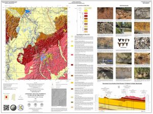
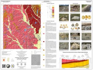 Our Office of Geology announces the release of three new surface 7.5 min. geologic quadrangle map publications and accompanying GeMS geodatabases of the Byram, Florence, and Whitfield covering portions of Hinds and Rankin counties in the greater Jackson Metro area.
The availability of updated and detailed geologic maps is of vital importance to our society. The Mississippi Geological Survey (under MDEQ as the Mississippi Office of Geology) has been conducting geological mapping and mineral resources studies for our state since 1850. These essential studies have played a vital role in many aspects of our state throughout its history including its mineral resources, agriculture, energy, economics, water resources, environmental, transportation, civil engineering planning, geohazards, and in the understanding and conservation of our natural and cultural history.
These three 7.5-minute geological quadrangle map publications were produced by MDEQ’s Mississippi Office of Geology under the United States Geological Survey’s StateMap cooperative research grant program. Geologic mapping is the core function of the Surface Geology Division of the State Geological Survey under MDEQ. These quadrangle are the first of their kind at this scale for these areas and this mapping research is conducted to document and better characterize the state’s geology in ever greater detail.
 The value in these research products is to better understand and characterize both the state’s economic and environmental resources. They serve as baseline data for economic and mineral resource development, ground water aquifer characterization and recharge, municipal planning and development, environmental planning and conservation, geohazards identification and mitigation, and for use by landowners to aid in private property resource management.
Some highlights of this research include:
- characterization of important sand, gravel, and limestone resources.
- Delineation of important aquifer recharge areas and their geologic framework in the shallow subsurface.
- delineation and sampling of geologic strata with potential for economic quantities of rare earth mineral deposits.
- Baseline stratigraphic setting of the area.
- Baseline environmental setting as it relates to lithologies, geomorphology, ecology, and the delineation of potential geohazards.
Some scientifically important aspects of these new research projects include:
- Documentation of important mineralogical and aggregate resources, including the potential for rare-earth minerals in carbonaceous clays, limestone, and aggregate resources.
- A more detailed understanding of the distribution of geologic formations at and near the surface affected by the structural influence of the Jackson Dome.
- Distribution of significant geohazard such as the Yazoo Clay and loessal soils particularly in areas of the greater Jackson metropolitan area with potential population growth, land and natural resource development.
- Documentation of important paleontological and geoarchaeological resources occurring in the study area.
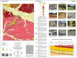
Check out the links to these high-quality products and the supporting cross-sections and other geologic content on these beautiful geologic maps:
OF-360 Geologic Map of the New Byram Quadrangle Hinds and Rankin Counties, Mississippi:
OF-360 Geologic Map of the New Byram Quadrangle Hinds and Rankin Counties, Mississippi – MDEQ
OF-361 Geologic Map of the Florence Quadrangle Rankin and Hinds Counties, Mississippi:
OF-361 Geologic Map of the Florence Quadrangle Rankin and Hinds Counties, Mississippi – MDEQ
OF-362 Geologic Map of the Whitfield Quadrangle Rankin County, Mississippi:
OF-362 Geologic Map of the Whitfield Quadrangle Rankin County, Mississippi – MDEQ
The Mississippi River Alluvial Plain

The geology and geomorphology of large fluvial systems is extremely complex. This is especially true of the largest fluvial system in the United States, the Mississippi River. The Mississippi River Alluvial Plain as we know it today was formed during the last ice age. Our great river evolved throughout the Pleistocene epoch, cutting deep channels into the Coastal Plain as glaciers grew more than one mile high over parts of the mid-continent to the north and seasonally melted, causing drastic changes in sea level. Its valley was filled with thick sediments from the glacial meltwaters as they made their way to the Gulf. This is a testament to water’s immense power and ability to shape our earth, creating an environment that is now our state’s largest agricultural region. It was not until Mississippi was able to utilize the tools of LiDAR for geologic mapping, coupled with extensive borehole and archaeological data, that the true complexity and beauty of our Mississippi River Alluvial Plain was properly interpreted by our State Geological Survey scientists at MDEQ. We are proud to release a comprehensive geological map of the Mississippi River Alluvial Plain this week for #mapmonday. This publication serves as a new foundation for our understanding of the Mississippi Delta region and is a significant contribution to our state’s next geologic map.
Hard copies of this publication are available for order through our MDEQ, Mississippi Office of Geology publications and map sales department and available for free download here.
The powerful story of our coastal evolution—one only geology can reveal.
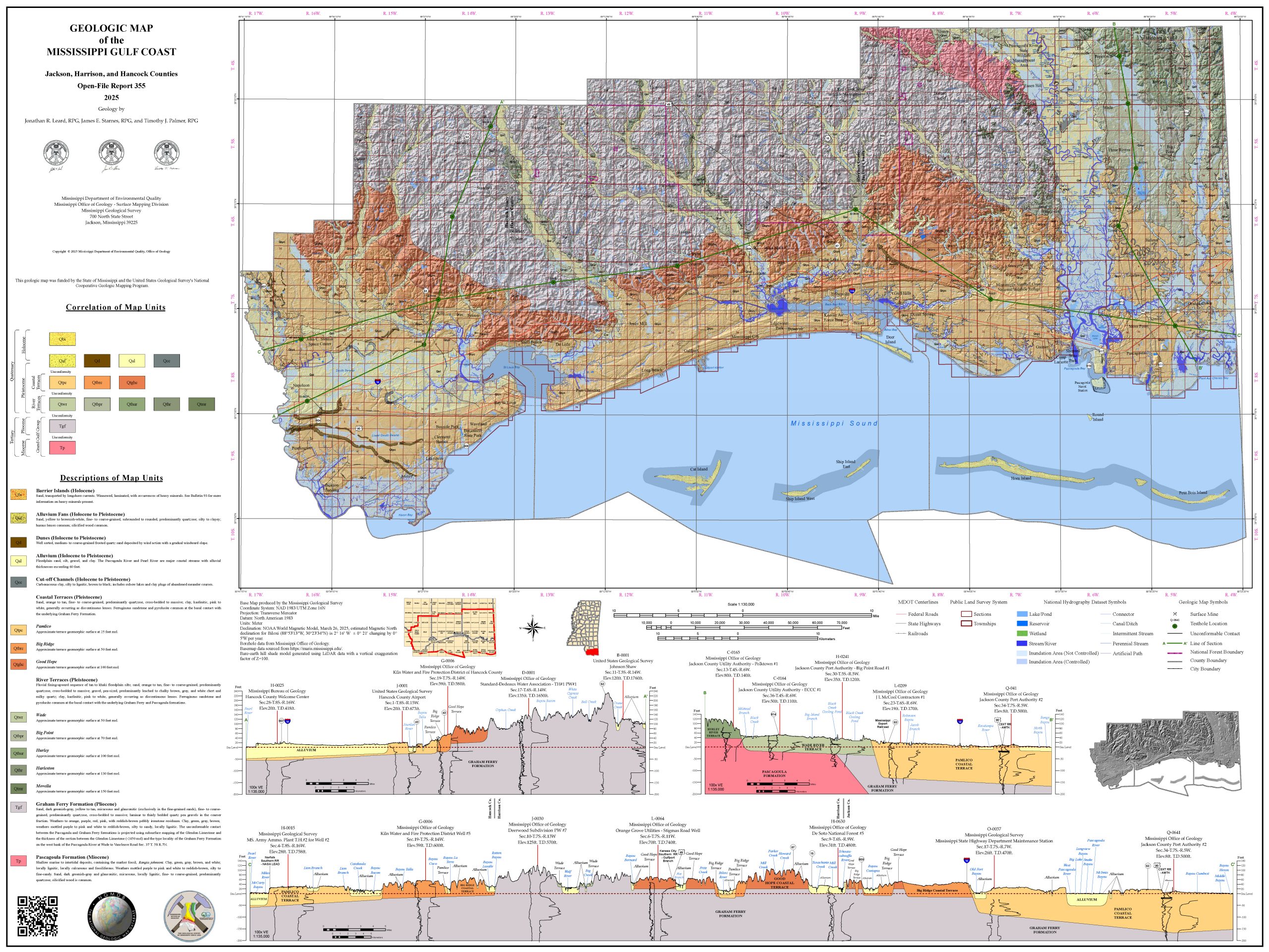
Our beautiful Mississippi Gulf Coast is a testament to the power of Mother Nature through deep time. The story of its natural history can only be unlocked through geologic mapping. The new tools of detailed lidar data coupled with test hole drilling and the study of fossils & outcrops helps our MDEQ’s State Geological Survey scientists tell the ancient story of our state’s coastal region.
The most influential part of this story can be found in the last few chapters of Earth’s history, recorded in the geology exposed at and near the surface. Our coastal region was largely shaped during the Pleistocene epoch, going back some 2.58 million years ago. During this time in earth’s history, sea levels rose and fell drastically due to cyclic glaciation. This left behind broad, coast-parallel terraces that were created during warm interglacial marine high-stands. Streams carved their valleys deep into the coastal plain as sea levels fell during the colder glacial episodes. The last glacial cycle ended some 11,700 years ago, as the last of the continental ice sheets melted. Sea levels finally rose to the coastline that we see today, only some 5,000 to 8,000 years ago.
We are proud to announce the release this week of a new publication by our State Survey scientists, the beautifully-detailed geologic map of our Mississippi coastal counties. This important project was funded by a cooperative grant with the USGS’s State Map geologic mapping program. It is a greatly updated interpretation of our coastal geology, depicted with detailed LiDAR, accompanying cross-sections, and unit descriptions. This map will provide an improved baseline for the understanding of the geologic framework of Mississippi’s amazing coastal region.
Hard copies of this publication are available for order through our MDEQ, Mississippi Office of Geology publications and map sales department and available for free download here.