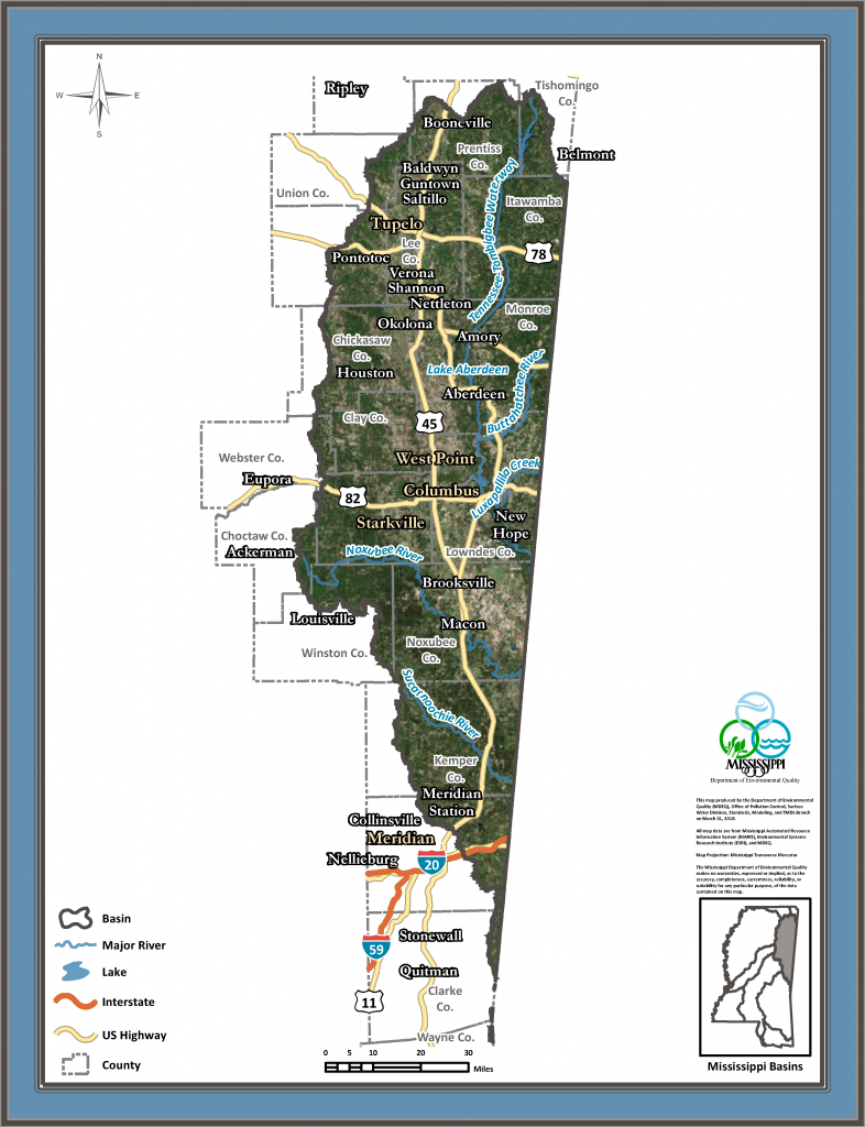
Tombigbee River Basin
The Tombigbee River Basin drains approximately 6,100 square miles of northeastern Mississippi and part of western Alabama. In Mississippi, the basin covers all or parts of 19 counties, and is about 190 miles in length and 48 miles in width. Major streams include the Tombigbee, Buttahatchie, and Luxapallila rivers, as well as Yellow and Hollis creeks. The most significant hydrologic feature in the basin is the Tennessee-Tombigbee Waterway, which stretches 137 miles from Tishomingo County through Lowndes County into Alabama using a series of dams, man-made canals, and portions of the original Tombigbee River channel.
Features
Approved Total Maximum Daily Load (TMDL) Reports
Each impaired water body will have a report completed for each pollutant causing impairment. Each TMDL report includes the suspected sources of impairment, and predicts a reduction of the pollutant necessary to restore the water body to its intended use. For more information about the TMDL program, please click on the TMDL Quick Link.
Water Quality Assessment Report- Section 305(b) Report
MDEQ monitors the quality of surface water throughout the state. Monitoring data and information are used to make water quality assessments. Assessments are general characterizations of water body health. The state’s most comprehensive assessment report is the Federal Clean Water Act Section 305(b) Water Quality Inventory Report. For more information about the 305(b) report and the water assessment process, please go to the Assessment Section Quick Link. The most recent 305(b) report with assessment information for this basin can be found at the link below.
Water Quality Impairments- Section 303(d) List
The Section 303(d) List of Water Bodies lists the impaired segments of specific water bodies, the location and length impaired, the cause of impairment, and the intended use.
Water Quality Standards
Surface waters (e.g., streams, rivers, lakes, estuearies, etc) are assigned intended uses. These designations allow regulatory agencies to establish water quality goals, which protect aquatic life and allow safe use by the public. These goals are referred to as Water Quality Standards. The designations that exist in Mississippi are Public Water Supply, Shellfish Harvesting, Recreation, and Fish and Wildlife (i.e., Aquatic Life Use Support and Ephemeral). Click the link below for a map or a list of the designated waters of the Tombigbee River Basin.
The Basin Management Approach, TMDLs, Assessments, and Standards Sections are all part of the Surface Water Division of MDEQ. For more information about activities relating to surface water, please visit the link to the Surface Water Division Home Page.
For more information, contact Natalie Segrest.